 CPS Resource Centre
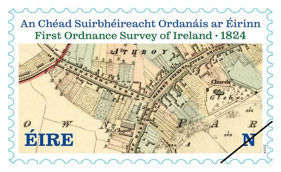
On June, 20, 2024 An Post (Ireland Post) released a new issue marking the First Ordnance Survey of Ireland in 1824. The single design, ‘N’ denomination (“national stamps” – currently valued at €1.35) issue is based on an 1836 map and features a small village area from Athboy Parish, in County Meath (northwest of Dublin). The horizontal format depicts crisp line work and detail common on maps from that time. Labeled roads, buildings, churches, trees and other features are visible on the colorful stamp.
 |
| An Post – June 20, 2024 First Ordnance Survey of Ireland, 1824 |
The backstory of the 200th anniversary of the first Ordnance Survey of Ireland was tied to the announcement of the OS 200 A Digital Archive of Ireland’s Ordnance Survey, a project supported by the University of Limerick, Royal Irish Academy, Public Record Office of Northern Ireland, National Library Ireland and the Digital Repository of Ireland. Using the DRI OS 200 collection, the 1836 map depicted on the stamp issue can be found here. News thanks to the always observant MapRoomBlog and monthly ICA/ICACI eCarto News. — web admin.